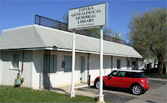
A question raised at our monthly program this evening (on the topic of Locating maps and plats on the Internet) has prompted this post -
Once you search through the deed books and find a record for the land that your ancestor owned, how do you translate it to find the physical location? Have you ever searched and searched for a map that would overlay the range and township grids with current roads and features so that you could figure out the exact location of the parcel? Ever wished for a simple way to convert that Range, Township, and Section legal description to a latitude and longitude that you could locate with your GPS device? If so, you will love the Earthpoint Tools website from Google Earth ( http://www.earthpoint.us/Townships.aspx ) . From this website, scroll down the page to where a heading says "Convert Township, Range and Section to Latitude and Longitude." Not only will this website make the conversion, there is also a link to view the point on google maps where you will be able to view to location on a map, zoom way in to the street or road level, and in many cases, see actual photos of buildings and terrain. It's the next best thing to being able to visit the site in person!
Thursday, October 22, 2009
Subscribe to:
Post Comments (Atom)


Wow, I have a place right here in Shawnee county that I will try.
ReplyDelete